Case Study:Irvine Ranch Water District – Evapotranspiration Data Portal
Submitted by IRWD
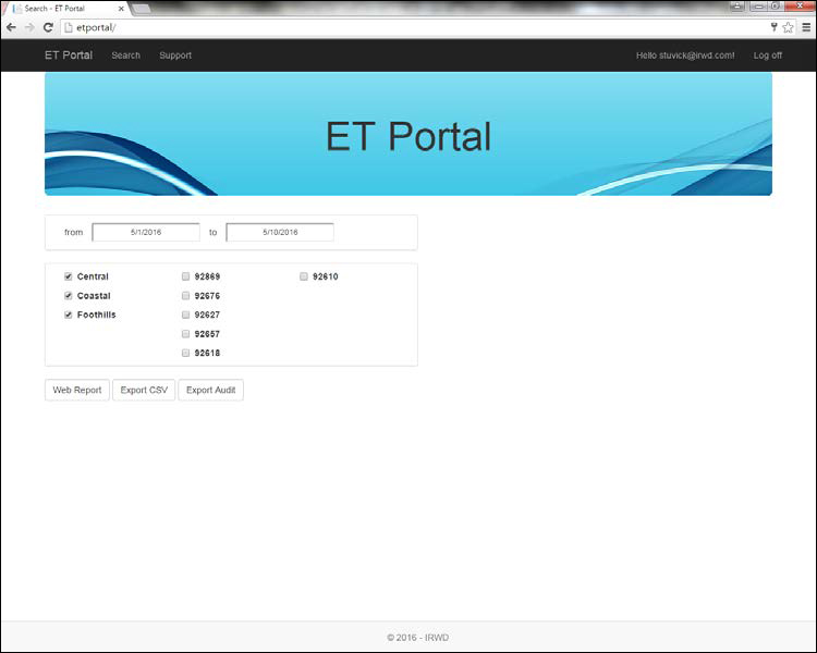
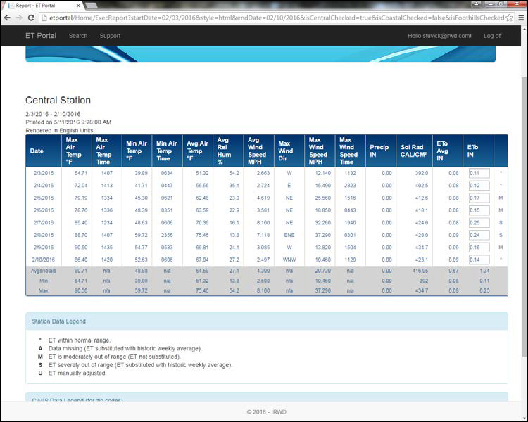
IRWD owns and maintains three weather stations. These stations are strategically located to reflect the variation of climate from the Pacific coast into the foothills. The Coastal, Central, and Foothill weather stations are serviced three times a year and the sensor equipment is calibrated twice per year. IRWD obtains the ET data using an ET Portal that routinely calls each station and stores the data. The portal contains ten years of historical ET values which is also provided in the form of a historical average for each day. Then, if a daily ET value is out of range, IRWD staff has the option to use the historical value. Out of range values are flagged as moderate (M) or severe (S).
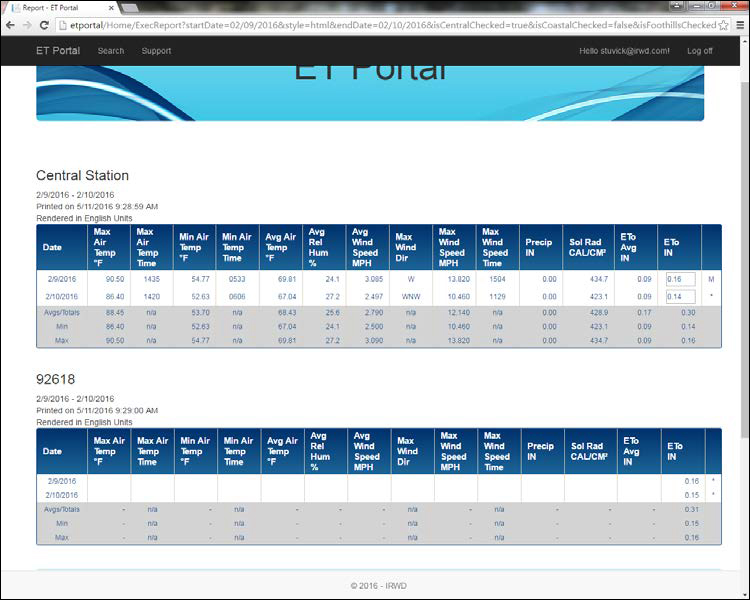
Data is also collected from Spatial CIMIS using the zip code for each weather station and additional zip codes for areas where the station coverage may not accurately represent the local ET. The zip code feature was built into the portal tool to allow the opportunity in the future for IRWD to choose to use CIMIS as a more representative ET data source for certain areas.The screenshots below show IRWD’s ET Portal and the data collected by weather station and for each zip code using Spatial CIMIS.